Skip to content
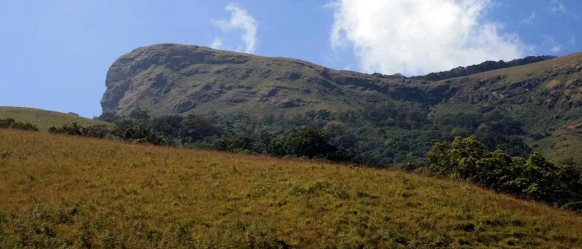
The horse-face summit ridge of Kudremukh Peak, seen from the approach trailWind4wings (CC BY 3.0), via Wikimedia Commons
Chikmagalur Kudremukh Mullodi Samse

Kudremukh Peak Trek: Permit, Route, Cost & Best Time

Difficult Best time: September to May — the Forest Department restricts access during the heaviest monsoon months7 min read
Overview

Overview

Kudremukh — "horse face" in Kannada, for the shape its summit ridge cuts against the sky — is Karnataka's second-highest peak at roughly 1,892–1,894 m, and the single most iconic trek inside Kudremukh National Park. The park itself was declared in 1987 and spans about 600 sq km across Chikmagalur and Dakshina Kannada districts — the second-largest protected tract of tropical wet evergreen forest in the Western Ghats, and one of the range's recognised biological hotspots. Three rivers — the Tunga, the Bhadra and the Nethravathi — are all said to originate within its boundaries.

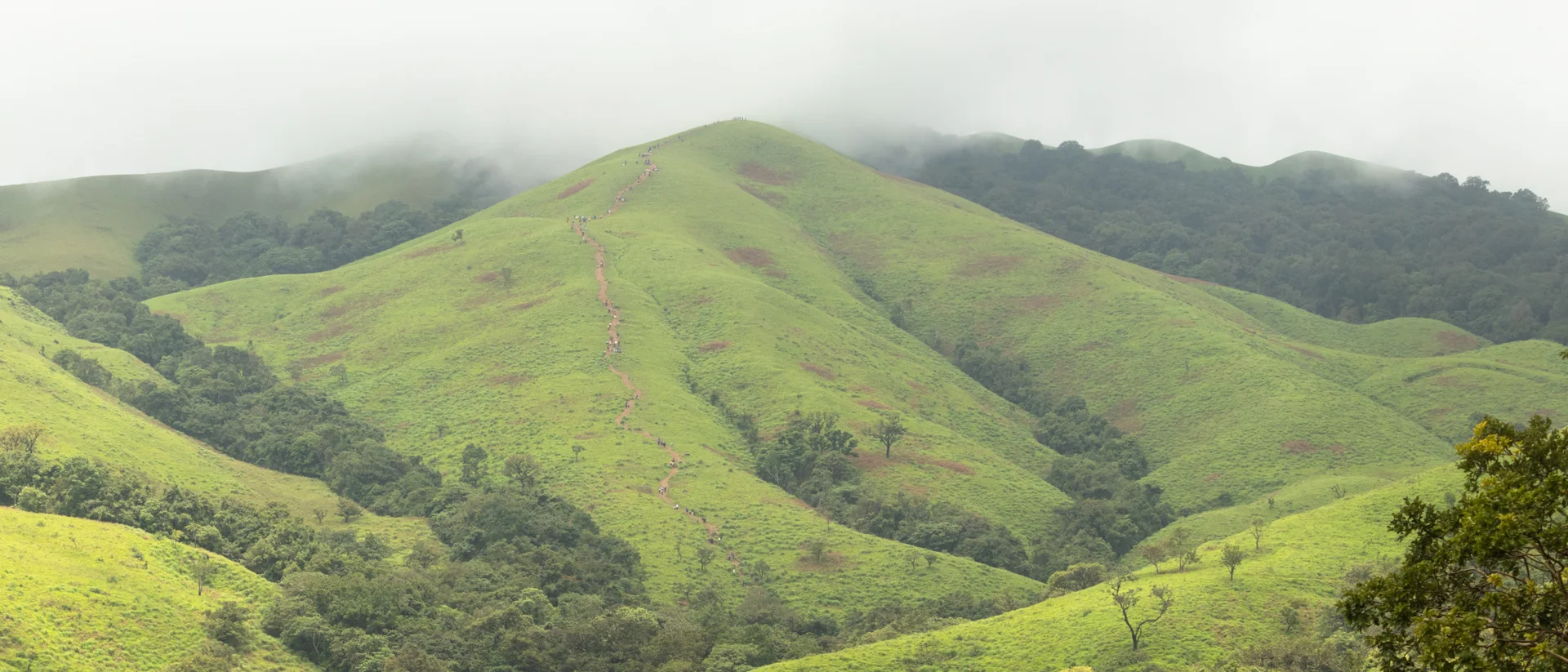
It shares its base area with the Nethravati trek (both start near Samse/Mullodi), but Kudremukh is the longer, more strenuous day: an 18 km round trip through dense Shola forest, stream crossings and open grassland to a summit with sweeping Western Ghats views.

Since 2024 every permit for this trek is issued online through the Forest Department's Aranya Vihaara portal — there is no walk-up or offline booking. A rugged jeep ride from Samse or Gadi to Mullodi village, the actual trailhead, is worth arranging in advance; it saves a genuinely rough stretch of approach road.
Distance

~18 km round trip

Duration

6–8 hours

Elevation

~1,894 m (2nd highest in Karnataka)

Base village

Mullodi, via Samse/Gadi

Day by day

Itinerary

  1. Day 1

    Day 1

    Reach Samse and jeep in to Mullodi

    • Most groups arrive at Samse the evening before. A 4x4 jeep from Samse or Gadi to Mullodi village — the real trailhead — costs roughly ₹2,000 return per vehicle and comfortably fits 6–8 people, splitting the cost well for a group.
    • Confirm your Aranya Vihaara permit and carry a printed or downloaded copy along with valid photo ID for every trekker.
  2. Summit and back

    Day 2

    Summit and back

    18 km6–8 hours

    • Start early — the Forest Department expects trekkers back out before dusk on an 18 km day. The trail moves through dense Shola forest and several stream crossings before opening onto grassland for the final climb.
    • The summit ridge gives the views the trek is named for — on a clear day, out across the Kudremukh range toward the coast.
    • Descend the same route; camping inside the forest is not permitted, so this is a there-and-back day trek, not an overnight on the hill.
Before you go

Costs & entry/exit rules

Costs

  • Forest entry & conservation fee₹275–₹575 per trekker

    Sources disagree on the exact current figure — confirm on the Aranya Vihaara portal at the time of booking.

  • Jeep, Samse/Gadi to Mullodi~₹2,000 return per vehicle

    Fits 6–8 people; arrange in advance with your homestay or local operator.

Entry & exit

Forest permit required

Start early from Mullodi so the 18 km round trip is finished well before dusk.

  • Book only through aranyavihaara.karnataka.gov.in — there is no offline permit option since 2024.
  • A registered Forest Department guide is compulsory.
  • Camping inside the national park is banned — this is a single-day trek, not an overnight.

Required documents

  • A valid government photo ID for every trekker, carried physically to the checkpoint
  • Your printed or downloaded Aranya Vihaara permit confirmation
What to carry

Packing list

Trekking shoes with strong grip — stream crossings and loose rock throughout 2–3L of water per person Rain jacket, even outside monsoon Packed breakfast and lunch — nothing is sold on the trail A torch or headlamp as backup Basic blister kit and personal medication
Who to call

Vendor contacts

Kudremukh National Park — Mullodi trailhead

Forest entry permit desk & mandatory trek guide handover

Kudremukh National Park — Mullodi trailhead

Contact number not confirmed yet — verify locally before travelling.

Questions

Frequently asked questions

Both start near Samse/Mullodi, but Kudremukh is the longer and more strenuous of the two — 18 km against Nethravati’s 14, with more elevation gain. Go in fitter than you would for Nethravati.

Book direct

Where to stay for this trip

Ayus Nature Homestay — green on every side
Meals included Pet friendly
4.8 out of 5, 74 reviews

Forest edge, Chikmagalur, Chikmagalur

Ayus Nature Homestay

A slow, green homestay where the forest starts at the gate

A quiet, green homestay on the forest edge — home-cooked meals, a garden that decides the menu, and birdsong loud enough to be the reason you wake up.

  • Kitchen garden
  • Home-cooked meals
  • Forest and waterfall walks

2 guests1 bedrooms1 bathsHomestay

₹2,700 ₹5,500 / night

View Details

Staging your Kudremukh attempt from Chikmagalur town? Ayus Nature Homestay is a comfortable base the night before an early start.

Keep exploring
The marked trekking trail climbing Nethravati Peak, Kudremukh National Park
Chikmagalur Kudremukh Samse

Trek guide 7 min read

Nethravati Trek Guide: Itinerary, Permits, Charges & Best Time

A 14 km round trip through shola forest and open grassland inside Kudremukh National Park, ending on a ridge with views across the Western Ghats.

September to May — trails turn slippery and leech-heavy during the June–August monsoon

Read guide